Friday, July 18, 2008

EMC Washoff in SWMM5

There are four steps to using EMC concentrations in your network:

1. Define your pollutant by adding a pollutant using the Data=>Quality=>Pollutant command:


2. Define the Land Use by using the Data=>Land Uses command or the Land Use Editor:


3. Define Buildup to be None by clicking on the None Tab:


4. Define the EMC Washoff concentration by clicking on the Washoff Tab:


This is where you would add a GW concentration
Zemanta Pixie


More: http://www.swmm2000.com/

Thursday, July 17, 2008

Hurricane Dennis Tampa 2005


Posted by Picasa

Papaya Bugs and Gators

Papaya Bugs and Gators in the Backyard

A bug on our backyard Papaya trees. The papaya trees survived but the frost of January 2008 killed many of the trees. They are growing back, however.


Posted by Picasa

Friday, July 11, 2008

PuddleBlog

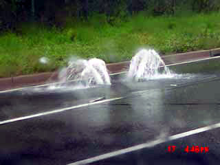
PuddleBlog is the image history of one small to large puddle on an American Street:

What is Puddleblog, you ask? Puddleblog chronicles the epic journey of one puddle, bracing for an uncertain future.

It’s a blog. You know, for a puddle. Specifically, the puddle that graces the corner of Jay and Plymouth, a couple blocks east of the Manhattan Bridge. Maybe if this thing catches on we can think about including other qualified puddles.

Tuesday, July 8, 2008

www.swmm5.info

Note www.swmm5.info now forwards to www.swmm2000.com which forwards to swmm2000.ning.com one of the wonderful Ning social network sites.
Zemanta Pixie

Saturday, July 5, 2008

SWMM 3,4 to 5 Converter Interface

SWMM 3,4 to 5 Converter Interface
The SWMM 3 and SWMM 4 converter can convert up to two files at one time to SWMM 5. Typically you would convert a Runoff and Transport file to SWMM 5 or a Runoff and Extran File to SWMM 5. If you have a combination of a SWMM 4 Runoff, Transport and Extran network then you will have to convert it in pieces and copy and past the two data sets together to make one SWMM 5 data set.

The x,y coordinate file is only necessary if you do not have existing x, y coordinates on the D1 line of the SWMM 4 Extran input data set.


You can use the command File=>Define Ini File to define the location of the ini file. The ini file will save your conversion project input data files and directories.


You can use the command File=>Define Your Text Editor to define the location of the text editor program. The ini file will save your conversion project editor name.


You can get a copy of the latest SWMM 3,4 to 5 Converter Here..
Zemanta Pixie

Friday, July 4, 2008

Hydrology in Ecclesiastes

Hydrology in Ecclesiastes

1:5 The sun also ariseth, and the sun goeth down, and hasteth to his place where he arose.

1:6 The wind goeth toward the south, and turneth about unto the north;
it whirleth about continually, and the wind returneth again according
to his circuits.

1:7 All the rivers run into the sea; yet the sea is not full; unto the
place from whence the rivers come, thither they return again.

Note:
This was a better description than in Aristotle.
Zemanta Pixie

Thursday, July 3, 2008

Hurricane Ivan in Pittsburgh, 2004


Pittsburgh
 International Airport recorded the highest 24-hour rainfall for Pittsburgh, recording 5.95 in. of rain. NWS Pittsburgh Climate Data, August, 2004." Hourly Climate Data. Pittsburgh, PA. 21 June 2006. http://www.erh.noaa.gov/pbz/hourlyclimate.htm

Posted by Picasa
Zemanta Pixie

Wednesday, July 2, 2008

Spatial Step in SWMM 5

SWMM 3,4,5 uses a spatial step equal to the length of the link. Or, in terms of the 1D St. Venant Equation for the calculation of flow used in SWMM 5:


In which is the length of the conduit.


The program will calculate the cross sectional area, hydraulic radius top width and depth at the upstream, midpoint and downstream sections of the link. The link solution is pivoted on the midpoint cross sectional area in the dominant dynamic wave terms and

and the non-linear term in the dynamic wave equation uses the upstream and downstream link cross sectional areas. In the finite difference equation in SWMM 5 the pipe shown below would have one length but use the cross sectional information from the upstream, midpoint and downstream points of the link.

The bend in the pipe would be modeled using the "other" category of losses


Zemanta Pixie

Tuesday, July 1, 2008

SWMM 5 Tools

In the newest version of EPA SWMM (5.0.1.11), there is a new feature of allowing for Add-ins and third-party tools. One such Add-in, the Microsoft Excel, can be very helpful for input data editing and model calibration.

1. To activate the Add-in
This process is detailed in pp. 141 of the EPA SWMM manual (http://www.epa.gov/ednnrmrl/models/swmm ... manual.pdf). Basically the user needs to go to "Tools->Program Preferences->Configure Tools" on SWMM main menu. Then in the pop-up "Tool Options" menu choose "Add." A "Tool Properties" window will pop-up, and the user can assign a name to the Excel Add-in for the "Name" field. For the "Program" field, the user needs to navigate to the location of the Excel executable file at "C:\Program Files\Microsoft Office\Office10\Excel.exe" (the file path may vary). Leave the "Working Directory" field as blank, and choose "INPFILE" macro for the "Parameters" field. Check both "Disable SWMM while executing" and "Update SWMM after closing."

After the above is set up, click OK and the Excel Add-in is registered in SWMM5. The Add-in tool is under the "Tools" menu. One important thing now is to go to "Tools->Program Preferences," and in the pop-up window check "Tab Delimited Project File."

2. Use the Excel Add-in
The SWMM5 input file by default is a tab-delimited .txt file. The user can view the file using Wordpad, but the editing is not very convenient, especially when it comes to calibration for a watershed with large number of subbasins. The Excel Add-in provides great relief for such operations.

Create a simple watershed model in SWMM, and then go to "Tools->Excel Editor (or whatever the user names the Add-in)." The input file for the watershed model is then displayed in tab-delimited format in Excel. In this environment, the user can edit the input data much easier (as compared to double-click each model component and key in the values in the Graphic User Interface). This becomes more apparent when the number of subbasins increases. When the editing is finished, close the Excel program, and then click "YES" or "OK" to all the pop-up windows. After that, the SWMM model interface pops back and the input parameters are updated.

So with this knowledge the model setup process can be much easier. In the initial model setup, the user may not bother to input any parameter values (i.e. subbasin area, width, slope, etc.). Instead, the model can be delineated and all components represented. Then the user can open the "Excel Editor" and copy/paste the model parameter values from another table of pre-created input parameter values (which is always the case). This process will totally by-pass the manually key-in of parameter values.

The second case of this feature applies is the model calibration. In a traditional way, suppose the user needs to change the value of depression storage for the impervious area. That means for a 30-subbasin watershed, the user needs to roam around the watershed and double-click 30 times to finish that single parameter change. Imagine if it takes five times to find the best value for that single parameter. With this feature, the user can open up the input file, set a depression storage value for the first subbasin, and then drag down for all the other 29 subbasins. Close Excel and go back to SWMM, and the updated model can be ran immediately.

Source: http://ceeforums.com/forum/viewtopic.php?f=26&t=256&p=582#p582
Zemanta Pixie

Global Rainfall


AI Rivers of Wisdom about ICM SWMM

Here's the text "Rivers of Wisdom" formatted with one sentence per line: [Verse 1] 🌊 Beneath the ancient oak, where shadows p...