- @InnovyzePatrick The reason we changed our Facebook Name was to emphasize the Software aspect of our company
 0 retweets0 likes
- 2016 #INFOSWMM Tweets about #HYDROLOGY #CSO #SWMM5 http://ift.tt/1PXE43F January 10, 2016 at 10:08AM
 0 retweets0 likes
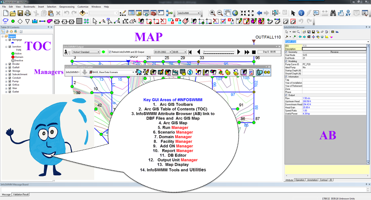
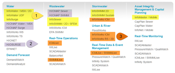
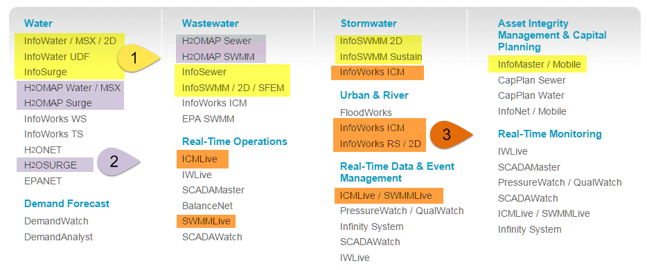
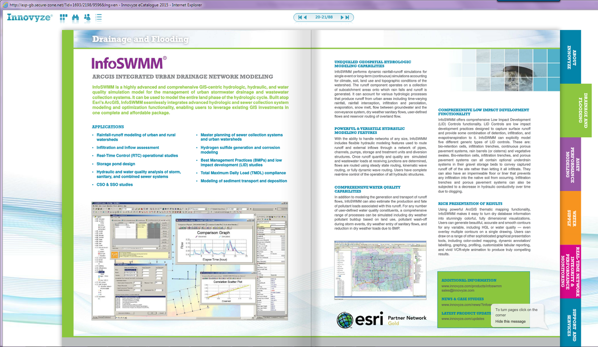
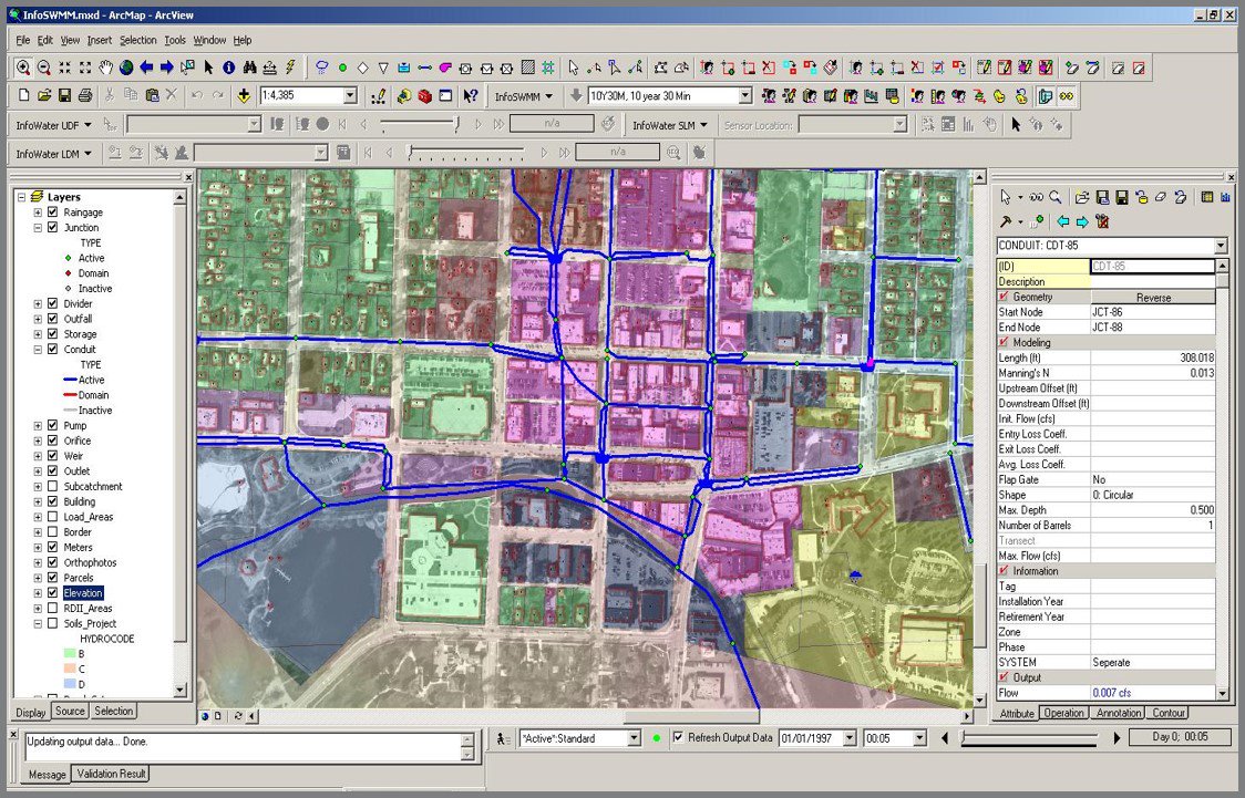
- 1 #INFOSWMM use #ArcGIS , 2 #H2OMAP_SWMM uses #MapInfo, 3 #INFOWORKS_ICM, #SWWMMLive Uses Custom A GUI @Innovyze
 3 retweets3 likes
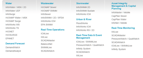
- Mini Tweetstorm about @INNOVYZE w/ Many Software Programs and Tools… http://swmm5.org/2016/01/10/mini-tweetstorm-about-innovyze-w-many-software-programs-and-tools-httpwww-innovyze-com-helps-plan-the-future-w-infomaster …
 1 retweet0 likes
Autodesk Technologist with Information about Stormwater Management Model (SWMM) for watershed water quality, hydrology and hydraulics modelers (Note this blog is not associated with the EPA). You will find Blog Posts on the Subjects of SWMM5, ICM SWMM, ICM InfoWorks, InfoSWMM and InfoSewer.
Wednesday, January 13, 2016
Tuesday, January 12, 2016
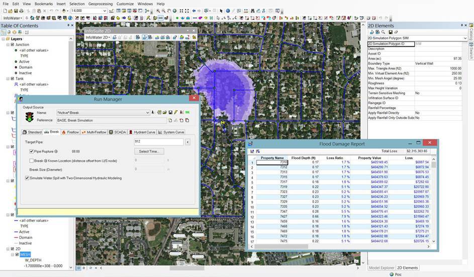
Predict & Assess Impact of Water Spills from Catastrophic Main Breaks Using InfoWater 2D
Predict & Assess Impact of Water Spills from Catastrophic Main Breaks Using InfoWater 2D http://ift.tt/1OYWbaz
Sunday, January 10, 2016
2016 #INFOSWMM Tweets about #HYDROLOGY #CSO #SWMM5
- 1 #INFOSWMM use #ArcGIS , 2 #H2OMAP_SWMM uses #MapInfo, 3 #INFOWORKS_ICM, #SWWMMLive Uses Custom A GUI @Innovyze

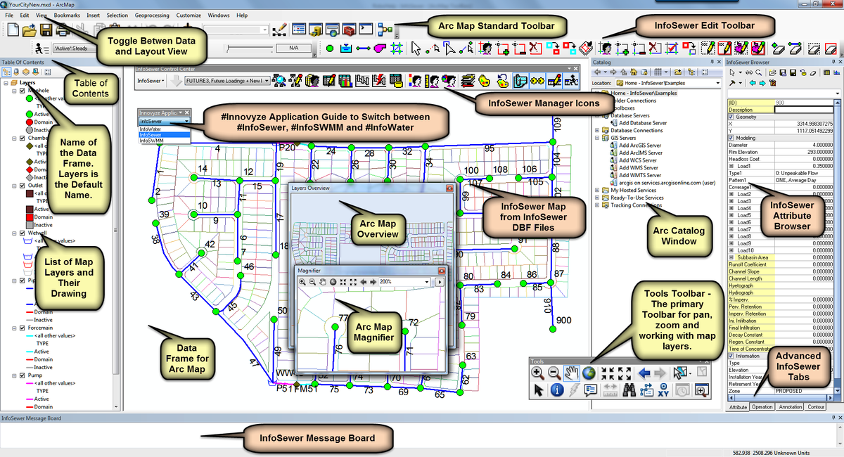
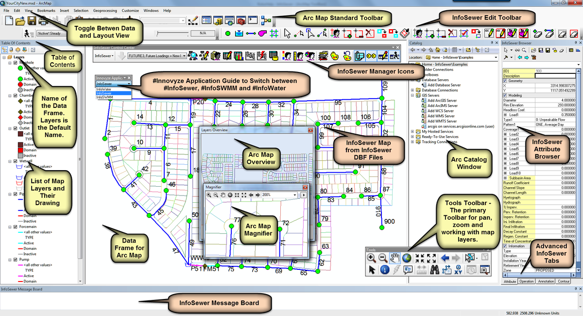
- How #INFOSEWER Maps its DB into #ARCGIS - A Similar Look in #INFOSWMM #iNFOWATER #INFOSURGE and #INFOMASTER
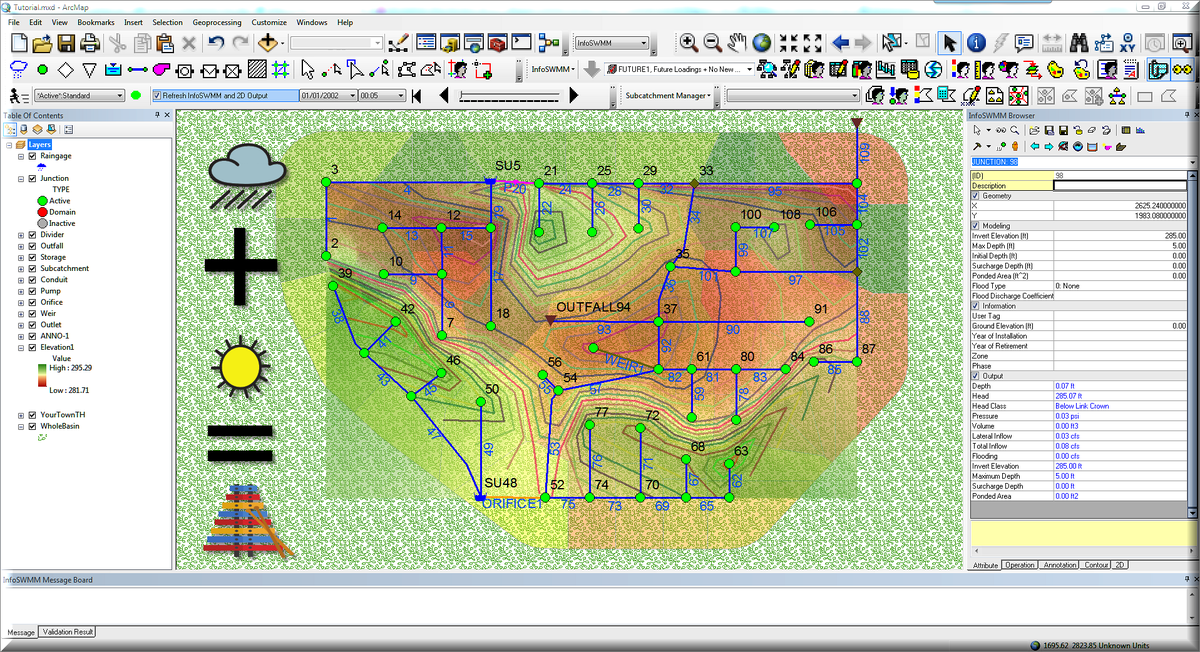
- Continuous Simulation! 1. Precipitation+ 2. Dry+ 3. Hydrology/Hydraulics = 4. #INFOSWMM #INFOWORKS_ICM #rt
- Tweet #1999 from @InnovyzeRobert Many Thanks To All at #INNOVYZE #MONROVIA for PSL Help for #INFOSWMM
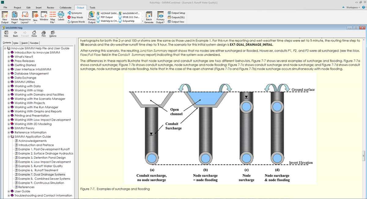
- Great feature of the #INFOSWMM and #H2OMapSWMM Help Files is a detailed Applicaation Guide h/t #EPA for H&HwWQ
- We welcome @LimnoTech in DC as our newest @Innovyze #InfoSWMM client...looking forward to helping in their upcoming modeling projects.
Newly updated SuDS Design training - based on CIRIA 2015 SuDS Manual (C753)
Newly updated SuDS Design training - based on CIRIA 2015 SuDS Manual (C753), 26-27 Jan London @Sudsulike http://iz4.me/D02ZUE1
This is a great SuDS - aka as #LID or Low Impact Development in North America
| ||
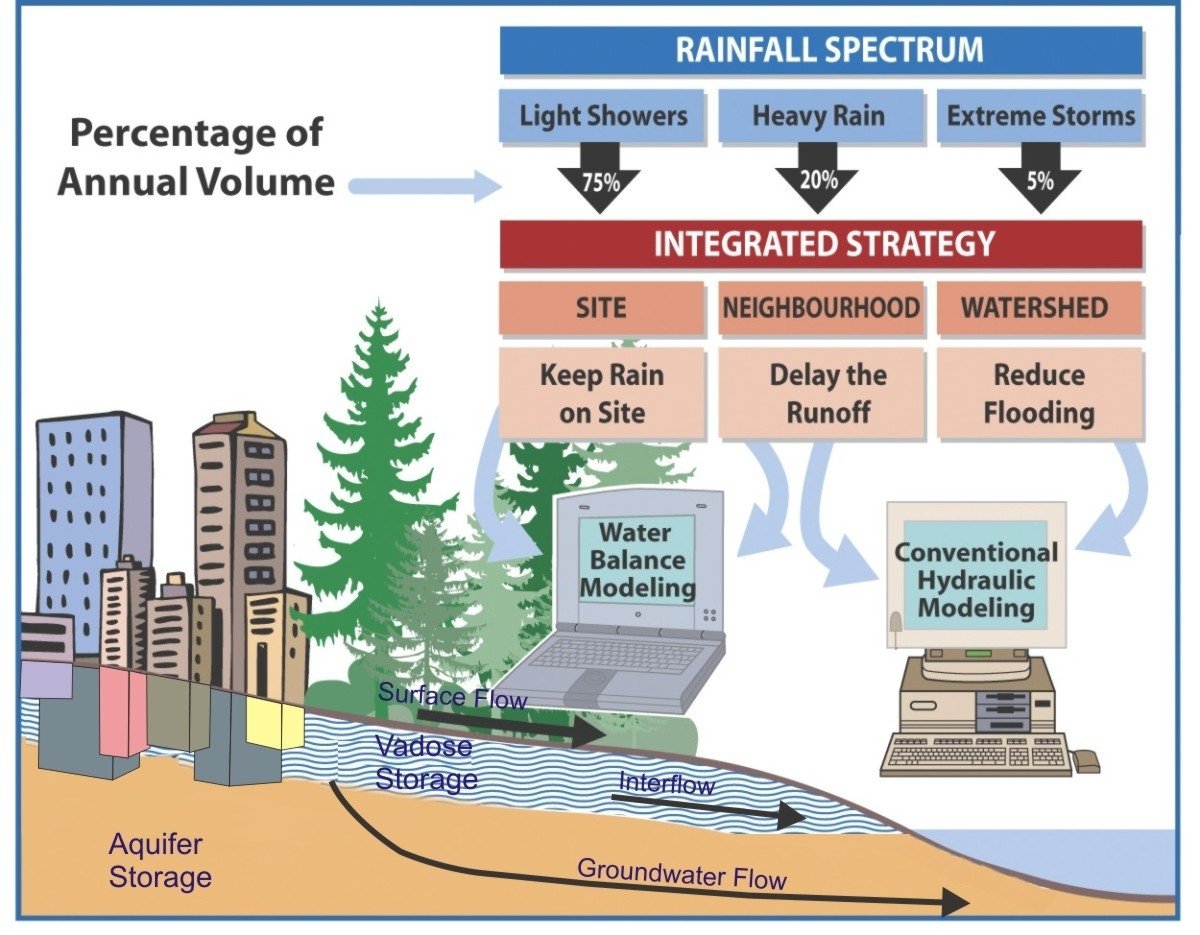
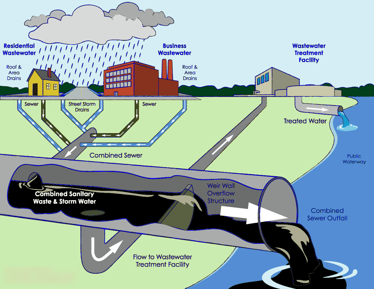
Many Water Cycle Images that look Great
Water Cycle (Cycle de l'eau - Cycle hydrologique) #STORMWATER #WATER @InnovyzeDavid https://t.co/tDG5FZMUqH pic.twitter.com/8qCMTBKoW0
— Robert Dickinson (@InnovyzeRobert) January 10, 2016
Friday, January 8, 2016
#Innovyze #InfoWater #2D: Predict Impact of #Water Spill from #WaterMain Breaks
#Innovyze #InfoWater #2D: Predict Impact of #Water Spill from #WaterMain Break https://t.co/KNRD0RJDPb #ARCMAP #rt pic.twitter.com/ohhbg5eVSv
— Robert Dickinson (@InnovyzeRobert) January 8, 2016
Wednesday, January 6, 2016
Happy to announce City of Oakland has selected #InfoSWMM Executive Suite to model their sewer collection system
Happy to announce City of Oakland has selected #InfoSWMM Executive Suite to model their sewer collection system pic.twitter.com/fWdC49LxT7
— Innovyze (@Innovyze) January 7, 2016
Tuesday, January 5, 2016
Innovyze Ships InfoWater 2D — Next Generation of Two-Dimensional Modeling of Water Spill from Catastrophic Main Breaks
Innovyze Ships InfoWater 2D — Next Generation of Two-Dimensional Modeling of Water Spill from Catastrophic Main Breaks
First of Its Kind Release Equips Engineers with Unmatched Power to Predict Extent, Duration, Volume and Impact of Water Spill for Rapid, Effective Response Management
Broomfield, Colorado, USA, January 5, 2016
Innovyze, a leading global innovator of business analytics software and technologies for smart wet infrastructure, today announced the worldwide availability of InfoWater 2D, a breakthrough geospatial water distribution network management solution for accurate two-dimensional (2D) above-ground modeling of water spill from main breaks and large leaks, directly within the powerful ArcGIS (Esri, Redlands, CA) environment.
Globally, water demand is rising, aging water infrastructures are rapidly deteriorating, and the impact of water main breaks and leakage is relentless. In the U.S. alone, drinking water systems maintain more than two million miles of distribution mains with about 237,600 water main breaks occurring every year. An estimated seven billion gallons of clean drinking water are wasted every day — a staggering 2.6 trillion gallons annually. Catastrophic water main breaks can result in anywhere from millions to billions of dollars in damages including disastrous litigations.
InfoWater 2D demonstrates Innovyze’s ongoing commitment to delivering pioneering technology that raises the bar for water distribution network modeling and simulation, helping to shape the future of this critical sector. It gives water utilities the flexibility to continue to use the industry-leading and award-winning InfoWater ArcGIS-centric water distribution network modeling solution with added new power to predict the extent, duration, volume and impact of water spill from main breaks and large leaks for rapid, effective response management.
Built atop ArcGIS, InfoWater 2D solves the full range of 2D free-surface shallow water equations using a highly advanced and efficient finite volume method. It gives engineers the unprecedented power to predict and assess potential water spill extent, depth and velocity throughout the flooded area, with results viewable as graphs, tables or animated thematic flood maps. Users can also add parcel maps with property values (cadastral mapping) as well as curves of depth versus property damage to assess the impact of flooding resulting from catastrophic water main breaks. This information is important for insurance-related property valuation, utility liability, and other financial impacts. It is also critical in enabling water utilities and municipalities to proactively identify water mains with the potential for the worst damage and prepare effective emergency response plans.
“InfoWater 2D greatly extends the core features of InfoWater, providing the most powerful and comprehensive ArcGIS-centric tool kit ever for estimating and managing the risks of water main breaks and large leaks,” said Paul F. Boulos, Ph.D., BCEEM, Hon.D.WRE, Dist.D.NE, Dist.MASCE, NAE, President, COO and Chief Technical Officer of Innovyze. “This milestone solution marks a new direction in advanced water distribution systems simulation and analysis. It is the only GIS-centric analysis, design and management software users need to work faster and smarter in a competitive environment — not only to power system performance, but to safeguard critical wet infrastructures and maximize their resiliency and effectiveness in protecting public health. This is the ultimate tool for accurately assessing the impacts of water main breaks and large leaks, then formulating and evaluating sound, cost-effective response strategies. Innovyze is very proud to offer this revolutionary emergency response product to our clients.”
Pricing and Availability
InfoWater 2D for InfoWater is available by subscription worldwide. Special upgrade prices are available for all existing InfoWater users. For the latest information on the Innovyze Subscription Program, including availability and purchase requirements, visit www.innovyze.com or contact your local Innovyze representative.
About InnovyzeInnovyze is a leading global provider of wet infrastructure business analytics software solutions designed to meet the technological needs of water/wastewater utilities, government agencies, and engineering organizations worldwide. Its clients include the majority of the largest UK, Australasian, East Asian and North American cities, foremost utilities on all five continents, and ENR top-rated design firms. With unparalleled expertise and offices in North America, Europe and Asia Pacific, the Innovyze connected portfolio of best-in-class product lines empowers thousands of engineers to competitively plan, manage, design, protect, operate and sustain highly efficient and reliable infrastructure systems, and provides an enduring platform for customer success. For more information, call Innovyze at +1 626-568-6868, or visit www.innovyze.com.
Innovyze Contact:Rajan RayDirector of Marketing and Client Service Manager
Rajan.Ray@innovyze.com
+1 626-568-6868
Monday, December 28, 2015
Innovyze President Dr. Paul F. Boulos Joins ACEC Design Professionals Coalition
Innovyze President Dr. Paul F. Boulos Joins ACEC Design Professionals Coalition
Broomfield, Colorado, USA, December 29, 2015
Innovyze, a leading global innovator of business analytics software and technologies for smart wet infrastructure, today announced that its president, COO and chief technical officer, Paul F. Boulos, Ph.D., BCEEM, Hon.D.WRE, Dist.D.NE, Dist.M.ASCE, NAE, has been appointed to the Design Professionals Coalition (DPC).
The DPC, a coalition of the American Council of Engineering Companies (ACEC), was established in 1983 to develop and advocate for policies related to the business interests of large design/engineering firms and the public good. Its membership includes senior executives of the nation’s leading engineering, architectural, surveying and mapping firms. Member companies are multi-disciplined, multi-practice firms with both domestic and international practices, and employ alternative project delivery as well as design-bid-build approaches.
“I look forward to working with this distinguished group of our industry’s most seasoned leaders to help our clients and governments meet the challenges of rebuilding our nation’s aging and failing critical infrastructure within the boundaries of limited financial and natural resources, increasingly stringent regulations, and the looming effects of climate change,” said Boulos. “The work we do carries with it tremendous social responsibility for the safety and well-being of the public, the health of the economy and the protection of the environment. It’s vital that we understand and meet the complex industry challenges we face with sound, innovative, sustainable solutions.”
Dr. Boulos joined MWH Global in 1991, delivering significant results for the company in a variety of technical, strategy and operational roles. In 1996, he founded Innovyze. Under his leadership, Innovyze has become one of the world’s most influential and innovative providers of water, wastewater and river modeling and simulation technology. The company has the highest operating margin in the AEC industry. Dr. Boulos is a Diplomate (by Eminence) of the American Academy of Environmental Engineers (AAEES), an Honorary Diplomate of the American Academy of Water Resources Engineers (AAWRE), a Distinguished Diplomate in Navigation Engineering by the Academy of Coastal, Ocean, Port & Navigation Engineers (ACOPNE), a Distinguished Member of the American Society of Civil Engineers (ASCE), and was elected to the National Academy of Engineering (NAE). He serves on the Boards of Directors of MWH Global and Innovyze.
For more information on the DPC, visit http://www.dpcweb.org/.
About InnovyzeInnovyze is a leading global provider of wet infrastructure business analytics software solutions designed to meet the technological needs of water/wastewater utilities, government agencies, and engineering organizations worldwide. Its clients include the majority of the largest UK, Australasian, East Asian and North American cities, foremost utilities on all five continents, and ENR top-rated design firms. With unparalleled expertise and offices in North America, Europe and Asia Pacific, the Innovyze connected portfolio of best-in-class product lines empowers thousands of engineers to competitively plan, manage, design, protect, operate and sustain highly efficient and reliable infrastructure systems, and provides an enduring platform for customer success. For more information, call Innovyze at +1 626-568-6868, or visit www.innovyze.com.
Innovyze Contact:Rajan RayDirector of Marketing and Client Service Manager
Rajan.Ray@innovyze.com
+1 626-568-6868
Tuesday, December 22, 2015
Monday, December 21, 2015
Job Posting - Sediment and Water Quality Transport in Urban Watersheds Research Participation Program Office of Research and Development National Risk Management Research Laboratory U.S. Environmental Protection Agency (EPA)
Sediment and Water Quality Transport in Urban Watersheds
Research Participation Program
Office of Research and Development
National Risk Management Research Laboratory
U.S. Environmental Protection Agency (EPA)
EPA-ORD/NRMRL-WSWRD-2015-04
Project Description:
Extra Note: Water resources job opening with @EPA in Cincinnati, Ohio for someone with a masters or PhD:
A postgraduate research project training opportunity is currently available at the U.S. Environmental Protection Agency’s (EPA), Office of Research and Development (ORD)/National Risk Management Research Laboratory (NRMRL). The appointment will be served with the Water Supply and Water Resources Division (WSWRD) in Cincinnati, Ohio.
The WSWRD conducts research on microbial contaminants, water treatment technology, urban water management, and water quality controls for the benefit of the nation.
The research opportunity will include activities such as:
- Formulation of numerical techniques for simulation of nutrient and sediment water quality transport.
- Development of initial solution prototype.
- Testing of prototype with analytical, synthetic, and field study data.
- Development of production code for SWMM based on prototype experience
- Preparation of research products documenting methodology and results.
The research participant will gain:
- Experience with numerical solution of advection-diffusion-reaction equations
- Knowledge of overland flow hydrology and numerical simulation of open channel flow hydraulics
- Experience with object oriented software design
- Experience developing software in C/C++.
Qualifications:
Applicants must have received a master’s or doctoral degree in civil/environmental engineering, hydrology, environmental science, or other related discipline within five years of the desired starting date, or completion of all requirements for the degree should be expected prior to the starting date.
The program is open to all qualified individuals without regard to race, sex, religion, color, age, physical or mental disability, national origin, or status as a Vietnam era or disabled veteran. U.S. citizenship or lawful permanent resident status is preferred (but a candidate also may hold an appropriate visa status; an H1B visa is not appropriate). Guidelines for non-U.S. citizens may be found at http://orise.orau.gov/epa/applicants/immigration.htm.
The appointment is full time for one year and may be renewed upon recommendation of EPA and contingent on the availability of funds. The participant will receive a monthly stipend. Funding may be made available to reimburse the participant's travel expenses to present the results of his/her research at scientific conferences. No funding will be made available to cover travel costs for pre-appointment visits, relocation costs, tuition and fees, or a participant's health insurance. The participant must show proof of health and medical insurance. The participant does not become an EPA employee.
Technical Questions:
The mentor for this project is Michael Tryby (tryby.michael@epa.gov).
How to Apply:
An application can be found at http://orise.orau.gov/epa/applicants/application.htm. Please reference Project # EPA-ORD/NRMRL-WSWRD-2015-04 when calling or writing for information.
Thursday, December 17, 2015
There was a change in EPA SWMM 5.1 to better represent Weekend vs Weekday Hourly flow patterns
There was a change in EPA SWMM 5.1 to better represent Weekend vs Weekday
Hourly flow patterns
1. Scenario Name
2. Junction ID for the node that receives the DWF
3. The item – either FLOW, MASS or Concentration (Use Blockedit to just
set this at Flow for all Rows) and you should fix your problem.
4. Value – the flow in the units defined in the Run Manager
5. Pattern1 – Can be Weekend, Hourly (Weekday only), Monthly or Daily
patterns. They can be in any order but Hourly only applies Monday to
Friday.
6. Pattern2 – Can be Weekend, Hourly (Weekday only), Monthly or Daily
patterns. They can be in any order but Hourly only applies Monday to Friday.
7. Pattern3 – Can be Weekend, Hourly (Weekday only), Monthly or Daily
patterns. They can be in any order but Hourly only applies Monday to Friday.
8. Pattern4 – Can be Weekend, Hourly (Weekday only), Monthly or Daily
patterns. They can be in any order but Weekend only applies to Saturday and
Sunday.
9. Alloc Code which is a tag from the DWF Allocator
It used to be that the two hourly patterns were applies as
… the week end flows are generated in the model by
multiplying Node DWF x Hourly x Weekend x Daily x Monthly.
But now
… the week end flows (Saturday and Sunday) are generated in
the model by multiplying Node DWF x Weekend x Daily x Monthly.
… the daily flows (Monday to Friday) flows are generated in
the model by multiplying Node DWF x Hourly x Daily x Monthly.
Wednesday, December 16, 2015
How to Tell how Long Normal Flow is used in a Link in #InfoSWMM, H2OMap SWMM w/ #SWMM5
How to Tell how Long Normal Flow is used in a Link in #InfoSWMM, H2OMap SWMM w/ #SWMM5
Find the Fraction of Normal Flow Limited in the Flow Classification Table and copy it to the Link Information Table - the value of FLM can then be Displayed in a Map using the Map Display command. In this small example, three links primarily used normal flow and one uses it for a short time. Normal flow only uses the Manning's equation and the link upstream depth, hydraulic radius and cross sectional area to compute the flow.
Find the Fraction of Normal Flow Limited in the Flow Classification Table and copy it to the Link Information Table - the value of FLM can then be Displayed in a Map using the Map Display command. In this small example, three links primarily used normal flow and one uses it for a short time. Normal flow only uses the Manning's equation and the link upstream depth, hydraulic radius and cross sectional area to compute the flow.
Tuesday, December 1, 2015
@INNOVYZE Smart network modeling for effective planning of sustainable urban areas
3/ @Innovyze #AWWA Journal of the American Water Works Association, 107(12), December 2015 .https://t.co/6UhFritXhc
— Innovyze (@Innovyze) December 1, 2015
2/ “Smart network modeling for effective planning of sustainable urban areas.”
Journal of the AWWA, 107(12), December 2015.
— Innovyze (@Innovyze) December 1, 2015
1/ Research Creates Success @Innovyze Read Boulos et al. on “Smart network modeling for effective planning of sustainable urban areas.”
— Innovyze (@Innovyze) December 1, 2015
“Smart network modeling for effective planning of sustainable urban areas.”Journal of the American Water Works Association, 107(12), December 2015.
Subscribe to:
Posts (Atom)
AI Rivers of Wisdom about ICM SWMM
Here's the text "Rivers of Wisdom" formatted with one sentence per line: [Verse 1] 🌊 Beneath the ancient oak, where shadows p...
-
@Innovyze User forum where you can ask questions about our Water and Wastewater Products http://t.co/dwgCOo3fSP pic.twitter.com/R0QKG2dv...
-
Subject: Detention Basin Basics in SWMM 5 What are the basic elements of a detention pond in SWMM 5? They are common in our back...
-
Soffit Level ( pipe technology ) The top point of the inside open section of a pipe or box conduit. The soffit is the ...
 Robert E Dickinson
 Robert Dickinson
 Peter Martin
 Innovyze